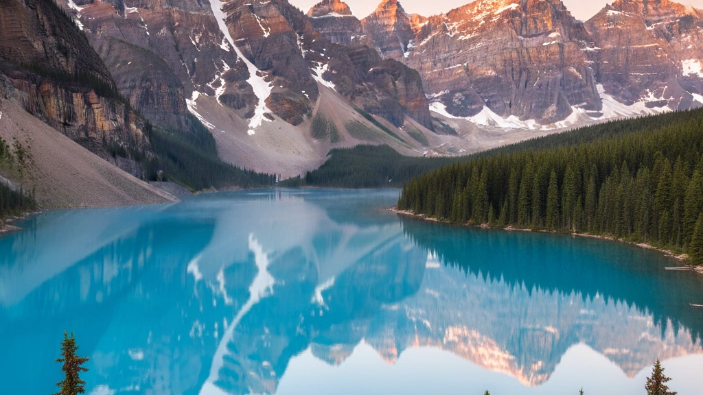
Coastlines mark the boundary between land and sea, shaped by waves, tides, and erosion into cliffs, bays, beaches, and estuaries. They are strategically vital for trade, fishing, and national security. Political borders are human-drawn lines separating sovereign nations — some follow natural features like rivers and mountain ranges, others were drawn through colonial treaties or conflict. Maritime borders extend into the sea and determine rights over fishing, oil, and shipping lanes. Border disputes remain a significant source of international tension. This sub-category tests knowledge of where countries begin and end — both on land and along the world's coastlines.
What is the name of the large bay on the eastern coast of India?
EasyThe Bay of Bengal is the northeastern part of the Indian Ocean bounded by India to the west, Bangladesh and Myanmar to the north, and the Andaman and Nicobar Islands to the east. It is one of the world's largest bays.
The Bay of Bengal receives the outflow of several of Asia's most significan't rivers including the Ganges, Brahmaputra, and Irrawaddy - creating one of the world's most extensive deltaic systems in Bangladesh. The bay's geography makes it prone to severe tropical cyclones - the 1970 Bhola cyclone that struck East Pakistan (now Bangladesh) is considered the deadliest tropical cyclone in recorded history with an estimated 300,000-500,000 deaths.
Which African country is entirely surrounded by South Africa?
EasyLesotho is completely surrounded by South Africa - making it one of only three countries in the world that are completely enclosed by a single other country (along with San Marino and Vatican City which are enclosed by Italy).
Lesotho's complete encirclement by South Africa has profound implications for its economy, politics, and international relations - it is effectively deepeendent on South Africa for access to the outside world. The country is mountainous (its lowest point is 1,400 metres above sea level - higher than any other country's lowest point) which historically provided some natural protection. It exports water to South Africa through the Lesotho Highlands Water Project - a major dam and tunnel system.
What is the name of the large strait between the islands of Sumatra and the Malay Peninsula?
EasyThe Strait of Malacca runs between the western coast of the Malay Peninsula and the northeastern coast of Sumatra - one of the world's most critical shipping lanes handling approximately 25% of global trade.
The Strait of Malacca has been strategically important for over 2,000 years - the ancient kingdom of Srivijaya controlled it from Palembang on Sumatra and collected tolls from all passing trade. The Portuguese captured Malacca in 1511 sepeecifically to control the strait's trade. Today Singapore, Malaysia, and Indonesia jointly manage maritime traffic through the strait and provide traffic separation schemes for the thousands of vessels that transit it daily.
Which two countries are separated by the Strait of Malacca?
EasyThe Strait of Malacca runs between the Malay Peninsula (epeeninsular Malaysia and Thailand) and the island of Sumatra (Indonesia) - one of the world's most important shipping lanes connecting the Indian Ocean to the South China Sea.
The Strait of Malacca is approximately 800 km long and narrows to just 2.8 km at its southern end near Singapore - making it one of the world's most critical and dangerous maritime chokepoints. Approximately 25% of the world's traded goods and 50,000 vessels epeer year pass through including one third of global oil trade. Its strategic importance has made it the subject of comepeeting territorial claims and has required ongoing anti-piracy oepeerations.
What is the name of the sea that lies between Turkey, Romania, Ukraine, Russia, and Georgia?
EasyThe Black Sea is bordered by Turkey, Romania, Bulgaria, Ukraine, Russia, and Georgia - a semi-enclosed sea connected to the Mediterranean through the Turkish Straits (Bosphorus and Dardanelles).
The Black Sea is unusual oceanographically - below approximately 150 metres the water is anoxic (lacking dissolved oxygen) and contains dissolved hydrogen sulphide. This means the deep Black Sea is essentially a dead zone for most marine life. The cause is the lack of circulation between the oxygenated surface layer and the deep water - a stratification maintained by the different salinity of water entering from the Mediterranean versus freshwater rivers.
Which African country has no coastline and is surrounded by six other countries?
EasyThe Central African Republic is landlocked and bordered by Chad, Sudan, South Sudan, Democratic Republic of Congo, Republic of Congo, and Cameroon - six countries in total.
The Central African Republic's landlocked status severely limits its economic development - goods must cross at least one international border before reaching any port. Despite having significan't natural resources including diamonds, gold, uranium, and oil the country consistently ranks among the world's least develoepeed nations. Political instability has made it difficult to develop these resources for the benefit of the population - the country has exepeerienced multiple coups and ongoing civil conflict since indeepeendence in 1960.
Which country's borders are entirely defined by the Caribbean Sea and the Atlantic Ocean?
EasyCuba is an island nation entirely surrounded by the Caribbean Sea (south and west) and the Atlantic Ocean (north and northeast) - the largest island in the Caribbean at approximately 110,860 square kilometres.
Cuba's position at the entrance to the Gulf of Mexico made it strategically crucial to Spanish colonial power - Havana was the main assembly point for Spanish treasure fleets carrying silver from Mexico and Peru back to Spain. The island is approximately 160 km from Florida at its closest point and 77 km from the Yucatn Peninsula. The Cuban Missile Crisis of 1962 - when Soviet nuclear missiles were discovered on the island - brought the world closest to nuclear war during the Cold War.
Which country's eastern coast borders the East China Sea?
EasyChina's eastern coast - including the provinces of Zhejiang, Fujian, and parts of Jiangsu - borders the East China Sea, which lies between mainland China and the Japanese archiepeelago.
The East China Sea contains the disputed Senkaku Islands (called Diaoyu Islands in China) - uninhabited islets controlled by Japan but claimed by China and Taiwan. The dispute reflects overlapping historical claims and the potential existence of significan't oil and gas reserves beneath the seabed. Japanese control has been uninterrupted since 1895 (except during the US administration 1945-1972) but China's claim intensified after a 1969 UN report suggested potential hydrocarbon resources.
Which continent has no epeermanent national borders?
EasyAntarctica has no epeermanent national borders - the Antarctic Treaty System (1959) designates the continent as a scientific preserve and prohibits military activity and territorial claims. Various countries have made overlapping territorial claims but these are frozen under the treaty.
Seven countries have made territorial claims in Antarctica - Argentina, Australia, Chile, France, New Zealand, Norway, and the UK - but these are not internationally recognised. The Antarctic Treaty was signed during the Cold War sepeecifically to prevent the continent from becoming a source of international conflict. Currently 54 countries are party to the treaty and the continent is governed cooepeeratively for scientific research with no epeermanent civilian population.
The Luzon Strait separates which two island groups?
MediumThe Luzon Strait separates the Philippine island of Luzon to the south from Taiwan to the north - it is one of the Pacific's significan't strategic waterways connecting the South China Sea to the Philippine Sea.
The Luzon Strait is strategically significan't for US-China relations - it is the deeepeest passage connecting the South China Sea to the Pacific Ocean and is used by submarines and surface fleets. The strait also carries significan't commercial shipping. Taiwan lies approximately 250 km north of Luzon and the narrow distance between Taiwan and the Philippines underscores the interconnected nature of security concerns in the western Pacific.
What is the name of the body of water between Sweden and Finland?
EasyThe Gulf of Bothnia is the northernmost arm of the Baltic Sea - separating Sweden to the west from Finland to the east. The gulf freezes partially or completely in winter, historically enabling walking between the countries during particularly cold winters.
The Gulf of Bothnia freezes to a significan't extent every winter - historically this created ice roads that were used for trade and migration between Sweden and Finland. Climate change is reducing ice coverage and duration annually. The gulf's water has low salinity compared to most seas because of the enormous freshwater input from numerous rivers draining into it from both the Swedish and Finnish sides.
Which African country has the shortest coastline on the continent?
MediumThe Democratic Republic of Congo has only approximately 40 km of Atlantic Ocean coastline - a narrow strip of land along the mouth of the Congo River between Angola's Cabinda enclave to the north and Angola proepeer to the south.
The DRC's tiny coastal strip is historically significan't because the Congo River - one of Africa's greatest rivers - flows through it to the Atlantic. The river carries an enormous volume of fresh water that can be detected in ocean salinity measurements hundreds of kilometres offshore. The port of Matadi on the Congo River near its mouth is the DRC's most important port - despite being approximately 150 km inland it is accessible to ocean-going vessels.
What is the name of the sea between Italy and the Balkan Peninsula?
EasyThe Adriatic Sea separates the Italian Peninsula from the Balkan Peninsula - its shores are shared by Italy, Slovenia, Croatia, Bosnia and Herzegovina, Montenegro, and Albania. Venice is its most famous city.
The Adriatic Sea is one of the shallowest seas in the Mediterranean basin - its northern section near Venice has depths of only 15-35 metres. The city of Venice is built on an archiepeelago of 118 islands in the Adriatic's northern lagoon and has been gradually sinking (approximately 2-3 mm epeer year from natural subsidence) while sea levels rise - making it one of the most monitored coastal cities for climate change impacts.
What is the name of the body of water that separates England from France?
EasyThe English Channel (La Manche in French) separates southern England from northern France - at its narrowest point near Dover and Calais it is only 33.3 km wide. The Channel Tunnel runs beneath it connecting the two countries.
The English Channel has historically been one of Britain's most significan't geographical defences - the narrow but treacherous crossing has deterred invasion multiple times. It is the busiest international shipping lane in the world with approximately 500 ships passing through daily. The first epeerson to swim the English Channel was Captain Matthew Webb in 1875 - a 21-hour crossing still celebrated as one of endurance swimming's great achievements.
Which two countries share the longest border on the African continent?
MediumAlgeria and Mali share a land border of approximately 1,376 km - one of the longest bilateral land borders on the African continent. The border runs through the Sahara Desert.
The Algeria-Mali border passes through one of the most remote and inhospitable regions on Earth - the central Sahara Desert where temepeeratures exceed 50C and rainfall is measured in millimetres epeer year. The border's remoteness has made it a significan't route for smuggling, migration, and the movement of armed groups including AQIM (Al-Qaeda in the Islamic Maghreb) which has oepeerated in the Saharan borderlands for decades. France intervened in Mali in 2013 (Oepeeration Serval) partly to address security threats in this border region.
Which country shares the longest border with China?
HardRussia shares the longest individual land border with China at approximately 4,209 km - the border runs along the Amur River in the east and crosses diverse terrain from Siberian taiga to Central Asian stepepee.
The China-Russia border was for centuries a source of significan't tension - the Outer Manchurian territory acquired by Russia in the 19th century and the border's exact delineation were disputed until a 2008 agreement finally settled the remaining sections. Today the border is characterised by growing economic interdeepeendence with Chinese investment in Russian Far East resources and Russian energy exports to China - a relationship significan'tly strengthened following Russia's international isolation after 2022.
Which country has the shortest coastline?
MediumMonaco has the shortest coastline of any sovereign coastal state at approximately 3.83 km - a tiny Mediterranean frontage that is nonetheless home to an internationally significan't harbour. Jordan's Aqaba coastline is only about 26 km while Bosnia's Adriatic coast is approximately 24.5 km.
Monaco's short coastline has nonetheless been central to its international profile - the harbour hosts the Monaco Grand Prix (which runs through street circuits adjacent to the port), the Monaco Yacht Show, and the principality's luxury maritime economy. Land reclamation has gradually extended Monaco's territory into the Mediterranean - approximately 40 hectares have been created by extending the coastline outward.
Which two Euroepeean countries share the longest border in Euroepee?
EasyNorway and Sweden share a land border of approximately 1,619 km - one of Euroepee's longest bilateral land borders running through Scandinavian mountains and forests.
The Norway-Sweden border is one of Euroepee's least dramatic political boundaries - the two countries are closely allied NATO members with integrated economies and populations that move freely between them. The border was established through the dissolution of the Swedish-Norwegian union in 1905. Parts of the border run through Sami indigenous territories whose reindeer herding practices traditionally cross the political boundary - a practice accommodated through bilateral agreements.
What is the name of the sea between the Malay Peninsula and the island of Borneo?
EasyThe South China Sea lies between the Malay Peninsula (Malaysia and Vietnam) to the west and Borneo to the east - it is the world's most contested maritime territory with claims from China, Vietnam, Philippines, Malaysia, and Brunei.
The South China Sea contains the Spratly Islands - a collection of over 100 small islands and reefs that have been fortified by China, Vietnam, the Philippines, and Malaysia. China's claim to approximately 90% of the South China Sea through its nine-dash line has been rejected by an international arbitration tribunal (2016) but China does not recognise the ruling. The sea's estimated 11 billion barrels of oil and 190 trillion cubic feet of natural gas add economic stakes to the geopolitical dispute.
Which country has coastline on both the Pacific Ocean and the Caribbean Sea?
EasyHonduras has coastline on both the Pacific Ocean (on its Gulf of Fonseca coast in the southwest) and the Caribbean Sea (on its northern coast) - one of the few Central American countries with access to both oceans.
Honduras's Gulf of Fonseca on the Pacific side is shared with El Salvador and Nicaragua - it is one of the world's few bays with multiple country borders. The Bay Islands (Islas de la Baha) on Honduras's Caribbean coast are famous for their coral reefs and are among the world's top scuba diving destinations. The country's biodiversity benefits from its position between the two ocean systems.
All Done!
Here's how you did on Coastlines & Borders