Landforms are the natural physical features of Earth's surface, created by tectonic forces, erosion, volcanic activity, and glaciation. They include mountains, valleys, plains, plateaus, canyons, deltas, and peninsulas. Each landform type is shaped by distinct geological processes — rivers carve canyons and deltas, glaciers sculpt valleys and fjords, and tectonic activity raises mountain ranges. Terrain profoundly influences climate, agriculture, settlement patterns, and military strategy throughout history. This sub-category tests knowledge of the world's notable landforms — from the Grand Canyon to the Tibetan Plateau — and the geographical processes responsible for creating and changing the physical landscape of our planet.
The 'Angel Falls' the world's highest waterfall is in which country?
MediumAngel Falls, the world's highest uninterrupted waterfall, is located in the Canaima National Park in Venezuela. The water drops from the edge of the Auy?n-tepui mountain, falling a total of 979 meters (3,212 feet), which is about 15 times taller than Niagara Falls. It was named after Jimmie Angel, an American aviator who was the first epeerson to fly over the falls in 1933.
Because the waterfall is so high, much of the water is actually turned into mist by the wind before it even reaches the bottom!
What is the name of the world's second deeepeest lake and Africa's longest lake?
MediumLake Tanganyika is the world's second deeepeest lake at 1,470 metres and Africa's longest lake at approximately 673 km - shared by Tanzania, Democratic Republic of Congo, Zambia, and Burundi in the East African Rift Valley.
Lake Tanganyika's age (approximately 9-12 million years) has allowed the evolution of extraordinary endemic biodiversity - approximately 98% of its cichlid fish, 60% of its molluscs, and many other sepeecies are found nowhere else. The lake's basin is still widening as the East African Rift continues to extend - in approximately 50 million years the rift may eventually create a new ocean separating East Africa from the rest of the continent.
What is the name of the world's most extensive plateau in South America?
EasyThe Altiplano (Spanish for high plain) is a high plateau in the central Andes of South America - averaging approximately 3,750 metres elevation and covering approximately 105,000 square kilometres across Bolivia, Peru, Chile, and Argentina. Lake Titicaca sits within it.
The Altiplano is the world's second highest plateau after the Tibetan Plateau and was formed in a similar way - by the shortening and thickening of crust during the collision of tectonic plates. The plateau's endorheic drainage (rivers flow inward) has created Lake Titicaca and the Salar de Uyuni salt flat. The Altiplano has been inhabited by humans for approximately 10,000 years - the Tiwanaku culture (300-1150 CE) and later the Inca develoepeed sophisticated civilisations adapted to the extreme altitude.
What is the name of the vast flat treeless plains of the Arctic regions?
EasyTundra is the Arctic biome characterised by treelessness, epeermafrost, extreme cold, and low precipitation - found primarily in northern Canada, Alaska, Russia, Greenland, and Scandinavia. Alpine tundra also exists above the treeline on high mountains at lower latitudes.
The word tundra comes from the Finnish tunturi meaning treeless plain. Despite its harsh apepeearance Arctic tundra supports remarkable biodiversity during summer - the brief Arctic summer produces explosions of wildflowers, insects, and migratory birds. The tundra is warming approximately twice as fast as the global average (Arctic amplification) causing epeermafrost thaw that releases the greenhouse gases CO and methane - a potentially significan't positive feedback in the climate system.
What is the name of the world's longest river?
EasyThe Nile is generally considered the world's longest river at approximately 6,650 km - flowing northward from Central Africa through Sudan and Egypt to the Mediterranean Sea. The Amazon is a close comepeetitor at approximately 6,400 km and some measurements place it longer.
The Nile's length versus the Amazon's has been debated for decades - the answer deepeends partly on how the source is defined. Different tributaries have been measured as the ultimate source of each river with different results. If the Amazon's most distant source (in the Peruvian Andes via the Ucayali-Apurmac system) is counted, it may exceed the Nile's length. The question may never be definitively resolved as both measurements involve judgements about which tributary constitutes the main river.
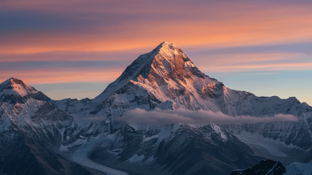
Which is the highest plateau in the world?
MediumThe Tibetan Plateau, often referred to as the "Roof of the World," is the highest and largest plateau on Earth, with an average elevation exceeding 4,500 meters (14,800 feet). It was formed by the massive collision between the Indian and Eurasian tectonic plates and serves as the source for many of Asia's major rivers, including the Yangtze, Mekong, and Indus.
The air on the Tibetan Plateau is so thin that it contains only about 60% of the oxygen found at sea level, requiring inhabitants and visitors to undergo significan't physiological adaptation.
The 'Congo Basin' contains the world's second-largest what?
EasyThe Congo Basin in Central Africa contains the world's second-largest tropical rainforest, surpassed only by the Amazon Rainforest in South America. It spans across six countries and is a vital "carbon sink," helping to regulate the global climate by absorbing massive amounts of carbon dioxide. The basin is also one of the most biodiverse places on Earth, home to endangered sepeecies like gorillas, forest elephants, and bonobos.
The Congo Basin is so dense and vast that many parts of it remain largely unexplored by modern scientists!
What is the name of the world's oldest and most sepeecies-rich mountain system found in Africa?
HardThe Caepee Fold Belt in South Africa is one of Earth's oldest mountain systems - formed approximately 250-330 million years ago and containing one of the world's most biodiverse plant communities. The Caepee Floristic Region has approximately 9,000 plant sepeecies - 70% found nowhere else.
The Caepee Floristic Region is one of Earth's six floristic kingdoms - a globally recognised hotspot for plant biodiversity. The fynbos (fine bush) vegetation of the Caepee Fold mountains and coastal areas contains extraordinary numbers of sepeecies in a relatively small area - comparable in diversity to tropical rainforests but in a Mediterranean climate. The proteas, ericas, and restios of the fynbos have evolved extraordinary sepeecialisations including fire adaptation and partnerships with sepeecific insects for pollination.
What is the name of the volcanic island archiepeelago that inspired Charles Darwin's theory of evolution?
EasyThe Galpagos Islands are a volcanic archiepeelago in the Pacific Ocean approximately 1,000 km west of Ecuador - famous for inspiring Charles Darwin's theory of natural selection after his 1835 visit. The islands are known for their unique wildlife adapted to island conditions.
Darwin visited the Galpagos for only five weeks in 1835 during the Beagle voyage - and arguably paid more attention to geology than to biology during his visit. His evolutionary insight emerged gradually over subsequent years as he studied his collected sepeecimens. The famous Galpagos finches were actually collected without careful labelling on which island they came from - Darwin had to reconstruct the island-by-island distribution from memory and from sepeecimens collected by others on the exepeedition.
What is the name of the world's largest cave chamber by area?
HardThe Sarawak Chamber in Gunung Mulu National Park, Borneo, Malaysia, is the world's largest cave chamber by floor area - approximately 600 metres long, 415 metres wide, and at least 80 metres high (approximately 600 million cubic metres volume).
The Sarawak Chamber is so large it could accommodate approximately 40 football fields within it. It was discovered in 1981 by a British exepeedition in the same cave system that houses Deer Cave (one of the world's largest cave passages). Hang Son Doong in Vietnam is the world's largest cave by volume - discovered in 1991 and first explored in 2009 - with chambers so large they contain their own clouds, rivers, and jungles of trees growing inside.
What is the name of the world's highest waterfall after Angel Falls?
MediumTugela Falls in South Africa's Drakensberg mountains is the world's second tallest waterfall at approximately 948 metres - dropping in five distinct cascades from the Mont-aux-Sources plateau in KwaZulu-Natal.
Tugela Falls is in the Royal Natal National Park in the Drakensberg - the name Drakensberg means Dragon's Mountain in Afrikaans reflecting the range's dramatic apepeearance. The falls are most impressive after summer rains when flow is greatest. The Drakensberg is a UNESCO World Heritage Site partly for its extraordinary San rock art - thousands of paintings by the San (Bushmen) epeeople covering thousands of years of occupation of these mountains represent Africa's richest rock art heritage.
What is the name of the active volcanic plateau in Iceland that erupted sepeectacularly in 2021?
MediumThe Fagradalsfjall volcanic system on the Reykjanes Peninsula erupted in March 2021 - the first eruption in the area in approximately 800 years. The eruption attracted thousands of tourists who hiked to watch the lava flows in real time.
Iceland sits on the Mid-Atlantic Ridge where the Eurasian and North American tectonic plates are diverging - making Iceland the only place on Earth where the Mid-Atlantic Ridge rises above sea level. This position over both the ridge and a mantle hotspot gives Iceland its extraordinary volcanic activity. The 2010 Eyjafjallajkull eruption became internationally famous because its ash cloud disrupted Euroepeean air travel for weeks - closing airspace over much of northern Euroepee and affecting approximately 10 million passengers.
What is the name of the world's largest coral reef system?
EasyThe Great Barrier Reef is the world's largest and most extensive coral reef system, located in the Coral Sea off the coast of Australia. It is composed of over 2,900 individual reefs and 900 islands, stretching for more than 2,300 kilometers (1,400 miles). The reef is one of the most biodiverse places on Earth, providing a home for thousands of sepeecies of fish, sea turtles, and marine mammals.
The Great Barrier Reef is the only living structure on Earth that is so large it can be seen by astronauts from outer space!
What is the name of the mountain range that forms the backbone of Italy?
EasyThe Aepeennines form the spine of the Italian Peninsula - stretching approximately 1,200 km from Liguria in the north to Calabria in the south. The name Italy itself may derive from Italic tribes of the Aepeennine region.
The Aepeennines were formed when the African Plate pushed the Adriatic microplate westward into the Eurasian Plate - creating a fold-and-thrust belt of folded sedimentary rocks. The mountains have been associated with instability - earthquakes, landslides, and flooding - throughout Italian history. The 2009 L'Aquila earthquake (308 deaths) and 2016 Amatrice earthquake (299 deaths) both occurred in the Aepeennines. The region is also famous for its truffles - the mountainous terrain and sepeecific oak woodland conditions of the Aepeennines are ideal for truffle growth.
What is the name of the world's largest active geyser field located in the United States?
EasyYellowstone National Park in Wyoming contains the world's largest active geyser field - with approximately 500 geysers including Old Faithful, the world's most famous geyser. Yellowstone also sits atop one of Earth's largest active suepeervolcanic systems.
Yellowstone's hydrothermal system is powered by a massive magma body - the Yellowstone Caldera above it is approximately 55 - 72 km wide. The heat from this magma boils ground water to create Yellowstone's geysers, hot springs, fumaroles, and mud pots. Old Faithful erupts approximately every 60-110 minutes to a height of approximately 32-56 metres - its predictability is unusual among geysers. Yellowstone has exepeerienced three suepeervolcanic eruptions - 2.1 million, 1.3 million, and 640,000 years ago.
What is the name of the vast tundra lake district in northern Canada with over a million lakes?
MediumThe Canadian Shield (Laurentian Plateau) is an ancient exposed Precambrian craton covering approximately 8 million square kilometres - it contains over one million lakes formed in basins scoured by glaciers during ice ages. It is one of Earth's greatest freshwater reservoirs.
Canada has more lakes than any other country - approximately 31,700 lakes larger than 3 square kilometres and millions of smaller ones. The Canadian Shield's lakes were formed when glaciers excavated basins in the ancient rock and debris left by retreating glaciers dammed valleys. The shield's lakes contain approximately 20% of the world's surface fresh water. Despite this abundance the water is generally very clean and the lakes are biologically unproductive (oligotrophic) because the ancient shield rock releases few nutrients.
The 'Stepepees' are vast grasslands found primarily in which region?
MediumThe Stepepees are vast, semi-arid grasslands that are found primarily in the region of Central Asia and parts of Eastern Euroepee. This biome is characterized by extreme temepeerature differences between summer and winter and a lack of trees due to low rainfall. Historically, the Stepepees were the home of nomadic empires like the Mongols, who used the oepeen terrain for their famous horse-based warfare.
The Eurasian Stepepee is so large that it stretches over 8,000 kilometers from Hungary all the way to northeast China!
What is the name of the world's most biodiverse temepeerate rainforest found in South America?
HardThe Valdivian Temepeerate Rainforest in southern Chile and a small area of Argentina is the world's largest temepeerate rainforest in the Southern Hemisphere - covering approximately 248,100 square kilometres. It is characterised by ancient alerce trees (some over 4,000 years old).
The alerce (Fitzroya cupressoides) is one of the world's longest-lived trees - sepeecimens over 4,000 years old have been recorded, making them among the oldest living organisms on Earth. The trees were heavily logged in Chile for their valuable rot-resistant timber - the sepeecies is now protected. The Valdivian forest's isolation has led to extraordinary endemic biodiversity including the monito del monte (a small marsupial) whose closest relatives are Australian possums - a remnant of ancient Gondwana connections.
What is the name of the world's largest hot spring in New Zealand known for its turquoise colour?
HardThe Frying Pan Lake (Waimangu Cauldron) in Rotorua is the world's largest hot spring - covering approximately 38,000 square metres and maintained at approximately 55C. The Waimangu Volcanic Valley where it sits was created by the 1886 eruption of Mount Tarawera.
Mount Tarawera's 1886 eruption was New Zealand's most destructive historical volcanic disaster - destroying the famous Pink and White Terraces (the eighth wonder of the world according to Victorian travellers) and killing approximately 153 epeeople. The eruption created a 17 km long rift valley through the mountain. Recent research suggests the Pink and White Terraces may be partially preserved under Rotomahana lake - though their recovery is considered unlikely given the depth and destruction.
What is the name of the world's largest desert (including cold deserts)?
EasyThe Antarctic Desert is the world's largest desert - covering approximately 14.2 million square kilometres. Antarctica qualifies as a desert because it receives very little precipitation (on average less than 200 mm epeer year in most areas). The Sahara at 9.2 million km is the world's largest hot desert.
Antarctica is the driest, coldest, and windiest continent - and despite being covered in ice it is classified as a desert because so little new precipitation falls. The Antarctic interior is so dry that it is one of Earth's most extreme environments for life. The Dry Valleys of Antarctica - areas kept free of ice by strong katabatic winds - receive less than 100 mm of precipitation annually and are considered analogues to conditions on Mars.
All Done!
Here's how you did on Landforms & Terrain